For Canadian commuters, the “best” navigation app is situational: Waze excels at outsmarting real-time urban chaos, Google Maps offers unmatched reliability for planned trips, and Apple Maps provides a streamlined, privacy-focused experience.
- Waze’s community-powered alerts for police, potholes, and construction are unparalleled for dynamic city driving.
- Google Maps’ superior offline capabilities and lane guidance are essential for navigating complex interchanges and data-dead zones in rural Canada.
- Apple Maps delivers a clean, less distracting interface that deeply integrates into the Apple ecosystem, prioritizing user privacy.
Recommendation: Use Waze for your daily grind through Toronto or Montreal traffic, but have Google Maps with downloaded maps ready for weekend trips to cottage country or beyond.
The daily commute in a major Canadian city is a unique battle. It’s not just about avoiding rush hour on the Gardiner Expressway or the Décarie Interchange; it’s a strategic game against surprise construction, pop-up potholes after a spring thaw, and the ever-present speed trap. For years, the debate has raged: Waze, Google Maps, or Apple Maps? Most comparisons offer the same surface-level take: Waze is for traffic, Google is the all-rounder, and Apple is for iPhone loyalists. This generic advice, however, fails the Canadian commuter who is trying to shave a precious 10 minutes off their drive.
These apps are more than just digital maps; they are complex systems trading data for convenience. While many focus on features like finding the nearest coffee shop, the real value for a commuter lies in proactive hazard alerts, reliable navigation without a data signal, and an interface that doesn’t become a dangerous distraction. The real question isn’t which app is “best,” but which is best for a specific, high-stakes Canadian scenario. Is it better at warning you about a lane closure on the 401 than it is at guiding you through a complex multi-lane exit?
But what if the key to winning the commute isn’t choosing one definitive champion, but understanding the situational superiority of each app? The true edge comes from knowing which tool to deploy for which battle. This analysis moves beyond the platitudes to dissect how each app performs under the specific pressures of Canadian driving: from its community intelligence in dense urban cores to its data privacy implications under Canadian law (PIPEDA) and its reliability when you’re deep in the Rockies with no bars of service.
This guide breaks down the competition across the scenarios that matter most to you, the daily driver. We will evaluate real-time alert effectiveness, offline performance, user interface safety, and the crucial privacy trade-offs, helping you build a smarter navigation toolkit to conquer your daily journey.
To help you navigate this comprehensive comparison, here is an overview of the key battlegrounds we will explore, allowing you to jump directly to the challenges that define your daily drive.
Summary: Waze vs. Google Maps vs. Apple: A Head-to-Head Comparison for Canada
- Police and Potholes: Which app has the most active community for real-time alerts?
- No Signal: Which app navigates best when you lose data in the Rockies or rural areas?
- Complex Interchanges: Which app actually tells you which lane to be in before the exit?
- Data Collection: How much location history are you trading for traffic avoidance?
- Dashboard UI: Which interface is less distracting to use while driving?
- Construction Season: How dynamic routing saves hours during Canadian summer roadwork?
- Auto Accessories: Practical winter car kits for Canadian commuters?
- AirTag vs. GPS: When is a consumer tracker enough and when do you need a subscription?
Police and Potholes: Which app has the most active community for real-time alerts?
For the urban commuter, avoiding surprises is the name of the game. A hidden speed trap or a tire-destroying pothole can ruin a morning far more than five minutes of traffic. This is where Waze’s core strength, its user community, creates a clear advantage. The app operates like a digital CB radio, allowing millions of drivers to report hazards in real-time. This crowd-sourced intelligence makes it uniquely effective at proactive alerts.
The data backs this up. In spotting police presence, Waze has been shown to be 30% more effective than Google Maps and 20% more effective than Apple Maps, giving drivers a crucial heads-up. While Google Maps (which owns Waze) incorporates some of this data, Waze remains the primary platform for active, user-submitted reports on everything from vehicles stopped on the shoulder to objects on the road. Apple Maps has been improving its reporting features, but it lacks the sheer volume and dedication of Waze’s user base.
A recent update in March 2024 further solidified Waze’s lead for Canadian drivers. The platform expanded its alert system to specifically include warnings for speed bumps, sharp curves, and toll booths—hazards that are particularly relevant during Canada’s notorious “pothole season” following the spring thaw. It also now alerts drivers to emergency vehicles stopped along the route, a feature made possible through its partnership programs with municipalities. For a commuter navigating the unpredictable streets of Toronto or Montreal, this level of granular, real-time information makes Waze the undisputed champion for situational awareness.
No Signal: Which app navigates best when you lose data in the Rockies or rural areas?
The Canadian landscape is vast, and reliable cell service is not a guarantee. Whether you’re heading to cottage country in Muskoka, exploring the Laurentians, or driving through the majestic Rocky Mountains, losing your data signal can turn a scenic drive into a stressful ordeal. In these moments, an app’s offline navigation capability becomes its most critical feature. Here, the competition shifts dramatically, and Waze’s greatest strength—its reliance on real-time data—becomes its biggest weakness.
Waze has extremely limited offline functionality. It requires a connection to start a route and cannot reroute you if you deviate without a signal. Apple Maps automatically caches routes you frequently travel, which can be helpful for daily commutes with known dead zones, but it’s not designed for exploring new, remote areas. This leaves Google Maps as the clear winner for offline navigation. It allows users to manually download large, detailed maps of entire regions—from a specific city to a whole province—directly to their phone. With a map downloaded, Google Maps can provide turn-by-turn directions and even perform limited rerouting without any internet connection.
This functionality is a non-negotiable for anyone who regularly travels outside major urban centres. The ability to pre-plan and download the map for a trip to Banff or a remote fishing spot ensures you have a reliable guide, regardless of cellular infrastructure. The trade-off is storage space, but it’s a small price to pay for peace of mind.
The table below summarizes how each app handles navigation when you’re off the grid, highlighting why preparation with Google Maps is key for any Canadian road trip. The following data is based on an in-depth analysis of offline map applications.
| Feature | Google Maps | Apple Maps | Waze |
|---|---|---|---|
| Offline Map Download | Manual selection of regions | Automatic caching of frequent routes | Limited offline capabilities |
| Offline Rerouting | Yes, with downloaded maps | Yes, with cached routes | No, requires initial connection |
| Storage Efficiency | Moderate to high | Low (automatic caching) | N/A (primarily online) |
| Best Use Case | Pre-planned remote trips | Daily commute with known dead zones | Real-time urban navigation |
| Canada Rural Coverage | Comprehensive | Good in major corridors | Limited in low-population areas |
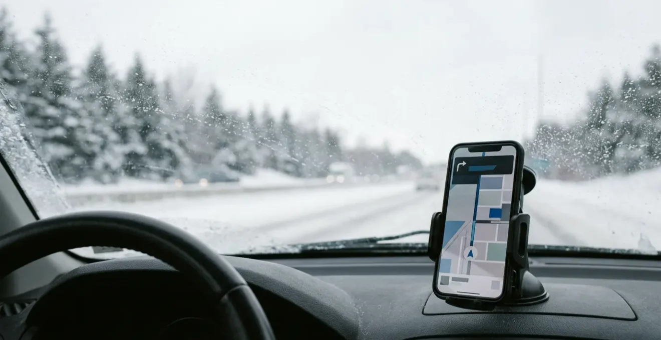
Complex Interchanges: Which app actually tells you which lane to be in before the exit?
Navigating a multi-lane highway interchange like Toronto’s 401/404 or Montreal’s Turcot requires more than just knowing the exit number; it demands being in the correct lane well in advance. A last-second, desperate lane change is not only stressful but also dangerous. In this high-stakes environment, clear, early, and precise lane guidance is a feature that separates a good navigation app from a great one.
For a long time, this was a weak point for all apps. However, recent advancements have created a clear leader. While Waze provides basic navigation and Apple Maps offers clean, simple directions, Google Maps has become the gold standard for lane guidance. Its system highlights the specific lane or lanes you need to be in for your next turn or exit, displaying the information prominently at the top of the screen with ample warning. This feature is invaluable when dealing with exits that split into multiple directions or highways with collector and express lanes.
Furthermore, Google is continually enhancing this visual clarity. As noted in a recent app comparison, its latest updates are pushing the boundaries of what’s possible on a dashboard screen. According to an analysis by Geeky Gadgets:
Google Maps has introduced advanced 3D mapping, providing highly detailed visuals of buildings, intersections, and landmarks.
– Geeky Gadgets, Best CarPlay Maps App in 2026 comparison
This move towards more realistic, 3D visualizations of the road ahead, combined with its already superior lane assistance, makes Google Maps the most confidence-inspiring choice for tackling Canada’s most intimidating highway systems. Apple Maps is also improving its visual detail, particularly in major cities, but Google’s implementation of lane guidance remains more consistent and reliable across a wider range of roads.
Data Collection: How much location history are you trading for traffic avoidance?
Every time you use a navigation app, you’re engaging in a transaction. You provide your location data, and in return, you get a path to your destination, hopefully with less traffic. But the nature of this data trade-off varies significantly between apps, a crucial consideration for privacy-conscious Canadians operating under the Personal Information Protection and Electronic Documents Act (PIPEDA).
On one end of the spectrum are Google Maps and Waze. As Google-owned products, they are data powerhouses. They collect vast amounts of anonymized location data from users to generate their incredibly accurate real-time traffic models and predict travel times. This is the engine that makes their dynamic routing so effective. However, this means your location history, search queries, and travel patterns are being stored and analyzed. While this data is linked to a user ID and not necessarily your name, it represents a significant digital footprint.
On the other end is Apple Maps, which has made privacy a core part of its brand identity. Apple employs techniques like on-device processing and “fuzzing” (making location data slightly less precise) to disassociate your navigation history from your personal Apple ID. It collects traffic density information without knowing the start or end point of individual trips. This approach provides a high degree of privacy, but it comes at a cost: its traffic prediction models and real-time rerouting can sometimes be less responsive than Google’s, as it’s working with a less detailed dataset.
The choice is a personal one. Do you prioritize the absolute best traffic avoidance, which requires contributing to a massive data pool? Or are you willing to accept potentially less-optimized routes in exchange for keeping your location history more private? For Canadian users, PIPEDA provides rights and protections, but the fundamental difference in how these companies approach data collection remains the key deciding factor.
Dashboard UI: Which interface is less distracting to use while driving?
A navigation app’s interface can be its greatest asset or its most dangerous flaw. A cluttered screen, confusing icons, or a hard-to-read map can pull a driver’s attention from the road at a critical moment. With distracted driving contributing to 22.5% of fatal collisions in Canada, according to Transport Canada, choosing an app with a clean, intuitive, and non-distracting User Interface (UI) is a matter of safety.
In this category, there’s a clear philosophical divide. Waze, with its community focus, has a more “gamified” and busy interface. It’s packed with icons for other users, police alerts, and hazards. While this information is valuable, it can also create significant visual clutter, demanding more of the driver’s cognitive load. Google Maps strikes a balance, offering a feature-rich map that remains relatively clean, with a focus on the route itself.
However, for pure, undistracted simplicity, Apple Maps generally takes the prize. Its interface is minimalist, with muted colours, clear typography, and a strong emphasis on showing only the most essential information at any given time. The turn-by-turn directions are large and easy to read at a glance. This streamlined design philosophy makes it arguably the least distracting of the three, allowing the driver to absorb the necessary information quickly and return their focus to the road. This is especially true when used within the Apple CarPlay environment, where its integration feels seamless and native.
For commuters in provinces with strict distracted driving laws, like Ontario, minimizing interaction with the device is legally required. Using an app with a simple UI and robust voice commands is key to compliance.
Your Action Plan: Ontario Distracted Driving Law Compliance Checklist
- Mount your device: Navigation apps must be used on a securely mounted device, not hand-held while driving or stopped at red lights.
- Limit touch interaction: You can only touch your mounted phone to make, answer, or end a call—programming a GPS while driving is illegal.
- Pre-program before driving: Enter your destination and configure route preferences before starting your vehicle to minimize taps on the road.
- Use voice commands: Activate voice-controlled features like “Hey Siri” or “Hey Google” for hands-free operation to comply with provincial laws.
- Enable driving mode: Activate your phone’s driving mode or use apps that block non-essential notifications during your trip.
Construction Season: How dynamic routing saves hours during Canadian summer roadwork?
Ah, the Canadian summer. It brings two things with absolute certainty: beautiful weather and a sea of orange construction cones. From highway expansion projects on the 401 to road repairs in downtown Montreal, “construction season” can turn a predictable commute into a chaotic, hours-long gridlock. This is where an app’s ability to dynamically reroute based on real-time traffic becomes its most valuable feature, and where Waze once again demonstrates its situational superiority.
While all three apps offer rerouting, Waze’s agility is unmatched. Because its traffic data is fed by millions of users actively reporting jams and slowdowns, it often detects problems faster than its competitors. This allows it to suggest alternate routes before you’re stuck in the thick of it. Google Maps is also excellent at this, but its updates can sometimes lag a few crucial minutes behind Waze’s instant community feedback. Apple Maps is the slowest to react to sudden changes in traffic flow.
This isn’t just a theoretical advantage; it translates into real-world time savings. As one driver noted in a long-distance comparison test:
Waze got us there 22 minutes faster because it pulled us off the highway before a three-car pileup that Google didn’t flag for another 8 minutes.
– Real-world test driver, Navigation app comparison on 500-mile route
This proactive rerouting is so effective that even government bodies are leveraging it. For instance, the Ontario Ministry of Transportation (MTO) integrates Waze traffic data into its own iCorridor transportation planning system. Waze provides the MTO with real-time alerts and traffic jam information, helping provincial planners respond to dynamic conditions during peak construction season. When the official provincial transport authority trusts your data to manage their highways, it’s a powerful endorsement of your app’s effectiveness at navigating construction chaos.
Key Takeaways
- There is no single “best” app; the winner depends on your specific commute and priorities (urban chaos vs. rural travel, performance vs. privacy).
- Waze’s real-time, community-sourced data is unbeatable for avoiding immediate hazards like police, potholes, and sudden traffic jams in cities.
- Google Maps is the essential tool for planned travel, offering superior offline maps for data-dead zones and the clearest lane guidance for complex highways.
Auto Accessories: Practical winter car kits for Canadian commuters?
Your navigation technology is only one part of your commuter toolkit. In Canada, being prepared for the environment is just as critical, especially during the harsh winter months. A dead battery, an icy patch, or getting stuck in a snowbank can happen to anyone, and having the right equipment in your vehicle can be the difference between a minor inconvenience and a genuine emergency. A navigation app can’t dig you out of the snow, so a practical winter car kit is a non-negotiable accessory.
Forget the pre-packaged, flimsy kits. A proper Canadian commuter’s kit should be built to handle real-world winter problems. The focus should be on self-rescue, visibility, and warmth. At a minimum, your trunk should contain:
- Traction Aids: A small bag of sand, cat litter, or traction mats can provide the grip needed to get out of an icy parking spot.
- A Sturdy Shovel: A compact, collapsible metal shovel is essential for digging out your wheels after a heavy snowfall or being plowed in.
- Booster Cables and a Power Bank: Extreme cold is the number one killer of car batteries. Good quality booster cables are a must, and a modern lithium-ion jump starter pack can get you going without needing a second vehicle.
- Warmth and Visibility: An emergency thermal blanket, extra gloves, a toque, a high-visibility vest, and a powerful LED flashlight or headlamp are crucial if you’re stranded at night.
- Basic Supplies: A small supply of non-perishable snacks (like granola bars) and a bottle of water are wise additions for any unexpected long waits.
This kit isn’t about preparing for a backcountry expedition; it’s about handling the 99% of winter commuting problems you’re likely to face, from a dead battery in a GO Transit lot to getting stuck on an unplowed side street. It’s the physical backup to your digital navigation tools.
AirTag vs. GPS: When is a consumer tracker enough and when do you need a subscription?
Beyond navigating from A to B, location technology can help answer another critical commuter question: “Where is my car?” The rise of consumer trackers like Apple’s AirTag has provided a cheap and easy way to keep tabs on personal items, but how do they stack up against dedicated, subscription-based GPS trackers for vehicle security and monitoring in a Canadian context?
The answer depends entirely on the use case. An AirTag is a passive, short-range finding device. It has no GPS of its own; it works by leveraging the network of nearby Apple devices. If someone with an iPhone walks past your car, the AirTag’s location is anonymously updated. This makes it a brilliant, low-cost solution for finding your car in a massive, crowded space with high Apple device density, like a concert venue parking lot or a multi-level parkade at a GO Transit or STM station. However, its effectiveness plummets in remote or low-traffic areas.
A subscription GPS tracker is an active, real-time tracking device. It uses its own GPS and cellular connection to broadcast its location, offering constant monitoring, geofencing alerts (notifying you if your car leaves a designated area), and detailed trip histories. This is professional-grade technology, ideal for anti-theft, monitoring teen drivers, or managing a small fleet of business vehicles. The monthly fee pays for the cellular data and platform access. These devices are also built to industrial standards, often performing better in the extreme cold that can drain an AirTag’s small battery.
The table below breaks down the key differences for a Canadian user.
| Feature | AirTag (Consumer) | Subscription GPS Tracker |
|---|---|---|
| Cost Structure | One-time purchase (~$40 CAD) | Monthly subscription ($15-30 CAD) |
| Network Dependency | Relies on nearby Apple devices | Dedicated cellular connection |
| Best Canadian Use Case | Finding car in GO Transit/STM parking lots | Fleet tracking across provinces |
| Cross-Border Tracking | Limited if Apple device density low | Works independently with GPS/cellular |
| Cold Weather Performance | Battery life affected by -30°C temperatures | Industrial-grade units designed for extreme cold |
| Recovery After Theft | Passive location when near Apple users | Active real-time tracking and geofencing |
For most commuters, an AirTag is a sufficient and cost-effective tool for the “Where did I park?” problem. But for those needing robust, real-time security and tracking across provincial borders, a dedicated GPS subscription is the only reliable choice.
Frequently Asked Questions on Navigation Apps & Privacy in Canada
What personal information can navigation apps collect under PIPEDA?
Under Canada’s Personal Information Protection and Electronic Documents Act (PIPEDA), navigation apps can collect location data, but only with meaningful consent. They must identify the purpose before or at the time of collection, limit collection to what’s necessary, and allow users to access and correct their information.
Do navigation apps need my consent to use location data in Canada?
Yes. PIPEDA requires organizations to obtain knowledge and consent before collecting, using, or disclosing personal information. For sensitive data like real-time location tracking, explicit consent is generally required. Apps must clearly explain why data is collected and allow you to withdraw consent.
How does Apple Maps’ privacy approach differ from Google Maps under Canadian law?
Apple Maps processes traffic data on-device to protect privacy, anonymizing information from millions of iPhones without tying it to individual Apple IDs. Google Maps and Waze (owned by Google) collect more detailed user data for traffic insights. Both approaches must comply with PIPEDA’s consent and transparency principles.
What happens to my navigation data when crossing the US-Canada border?
When your location data crosses the border, it may be subject to foreign laws, including US government access requests. PIPEDA requires apps to inform you if data may be transferred outside Canada and could be accessed under foreign country laws. This is particularly relevant for cross-border commuters between cities like Windsor-Detroit.